Calibration BasinsLast Updated July 24, 2001 There are two basins which can be used by modeling groups to calibrate parameters which are not prescribed by Rhone-AGG (see Table 4.1 of the Rhone-AGG experimental description). Aspects of the basins are summarized in Table 6.1. The contributing area fractions (CAF) for the two basins are shown in Fig. 6.1 together with the topography of the basin. The masks are shown in Fig. 6.2. The atmospheric forcing and surface/soil/vegetation parameters for Experiment 1 on the 8x8 km grid are to be used for the calibration. The total daily runoff from a SVAT scheme can be compared to the observed discharge (Fig.6.3) on the data distribution (CD). The daily observed discharge is provided for the entire 4-year simulation period (Aug. 1, 1985, to July 31, 1989). It is not necessary to report the final calibration results to us (by default they will be included in the Experiment 1 outputs). However, we would like each group to:
The daily river discharge for each of the two calibration basins can be calculated using the total runoff (surface, lateral and baseflow/drainage) simulated by the participant SVAT scheme. Please note that the total simulated discharge from each of the basins should be calculated using the corresponding observed basin area listed in TABLE 6.1 (and on the CD distribution), and not the simulated area which can be calculated using the CAF (also shown for reference in TABLE 6.1). Please see the related email on the Memos page for more details. TABLE 6.1 Calibration basin characteristics (shown in Fig.s 6.1 and 6.2). The contributing area, average grid box altitudes, number of masked points and the basin ID (mask index) are shown.
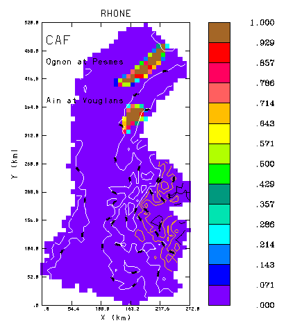 FIG. 6.1 The contributing area fractions (CAF) for the two calibration basins. Contours of the grid-box average altitude is also shown: white lines correspond to heights of 500 and 1000 m, red lines correspond to 1500 and 2000 m, and black lines correspond to 2500 and 3000 m. 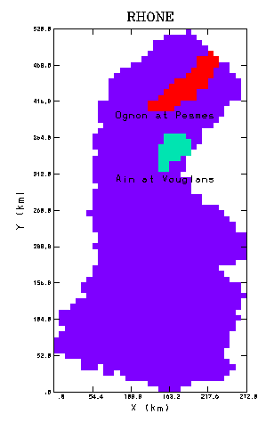 FIG. 6.2 The grid masks for the two calibration basins. 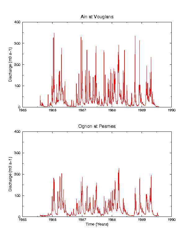 FIG. 6.3 The observed daily discharge at the two gauging sites which is available for model calibration. |