Old Version Archive
Information
Note
The database distributed in this page is old versions of the GWD-LR. For the latest version, please go to the frontpage.
GWD-LR ver 1.1
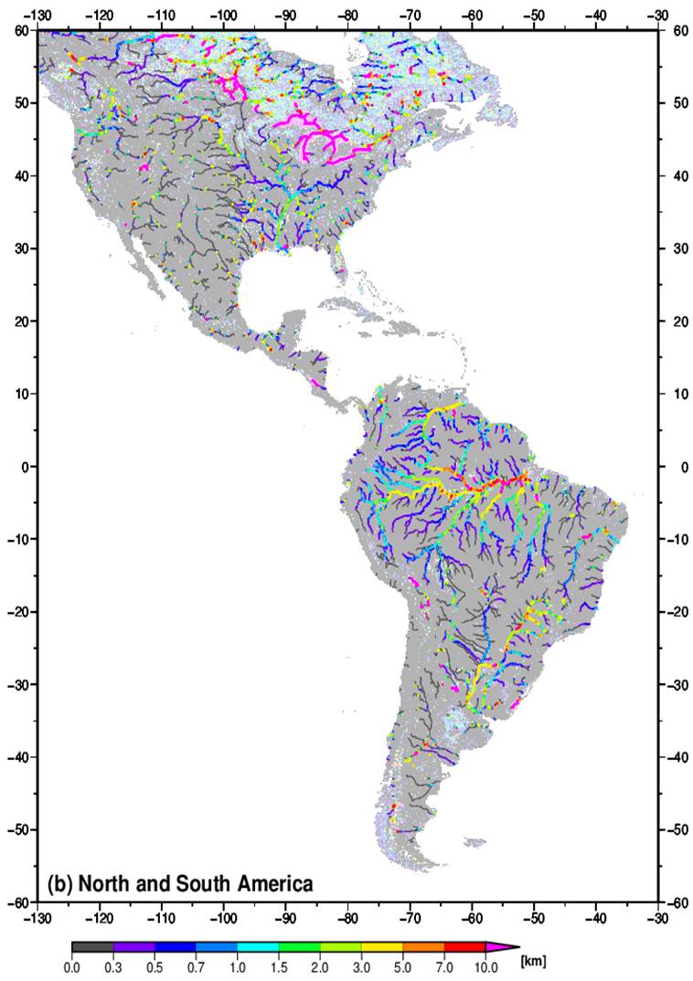
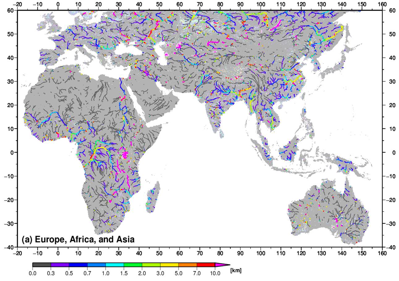
The GWD-LR represents effective river width (excluding islands). The original resolution of GWD-LR is 3 arc-sec (~90m), but the version in this website is upscaled to 1/40 degree (~2.5km). The coverage of the GWD-LR is between 60N and 60S following the availability of SWBD and HydroSHEDS.
The data format is ESRI 'BIL' raster format with the HDR description file. The CTL file for GrADS is also included. The data type is 4 byte integer (little endian). Undefined value is -9999, land pixels are represented by 0, and water body and channel pixels without width data are represented by -1. The GRWD is devided into eastern and western region (grwd_east, grwd_west).
Please contact to the developper (Dai Yamazaki) if you are interested in the original 90m database.
NOTE: Minor errors around n55w090, n55w060, n55w010 are corrected (ver1.1 on 06/03/2014)
GRWD East ver1.1
Longitude 20W-160E (7200 pixel), Latitude 60N-40S (4000 pixel).
-- download GRWD East [[password required]] --
GRWD West ver 1.1
Longitude 130W-30W (4000 pixel), Latitude 60N-60S (4800 pixel).
-- download GRWD West [[password required]] --