Distributed Hydrological Model in Hanjiang River
Dataset
Geographical Information
Geographical information, including topography, land use, soil type and vegetation, was used for GBHM. Details can be found in the following table and figures.
| Topography | USGS DEM | 100m |
| Land Use | reclassified into 8 categories | 1:100000 |
| Vegetation | GIMMS-NDVI | 8km |
| Soil | FAO | 10km |

Meteorological Information
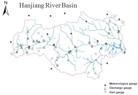
Meteorolgical information including discharge data, meteorological data and rainfall data are another part of the datasets. Discharge data was used for model calibration and validation, while the meteorological and rainfall data were used as the input of GBHM model. Distribution of the gauges can be seen in the figure below.
Model Construction
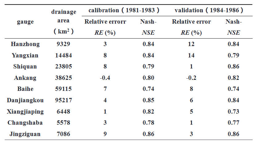
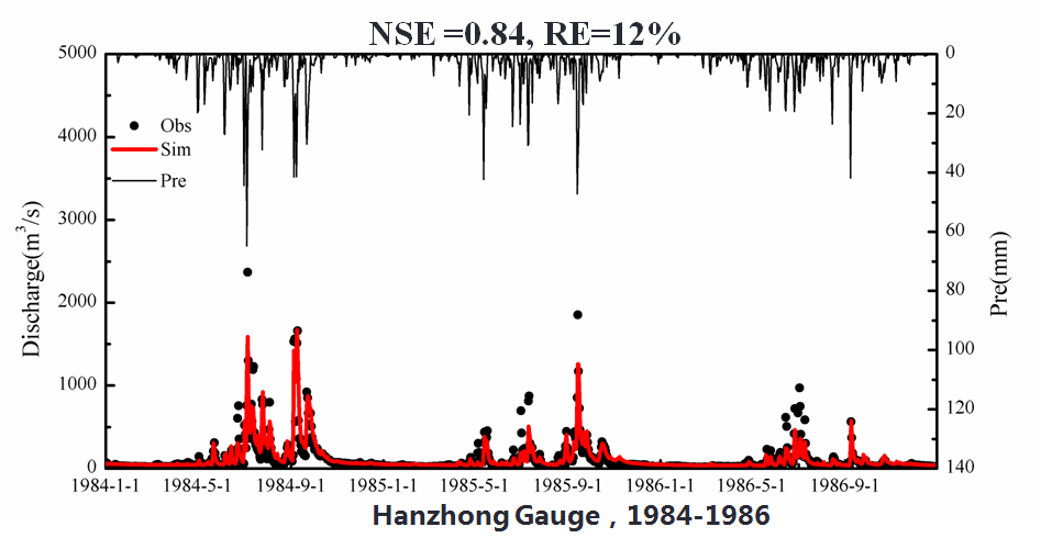
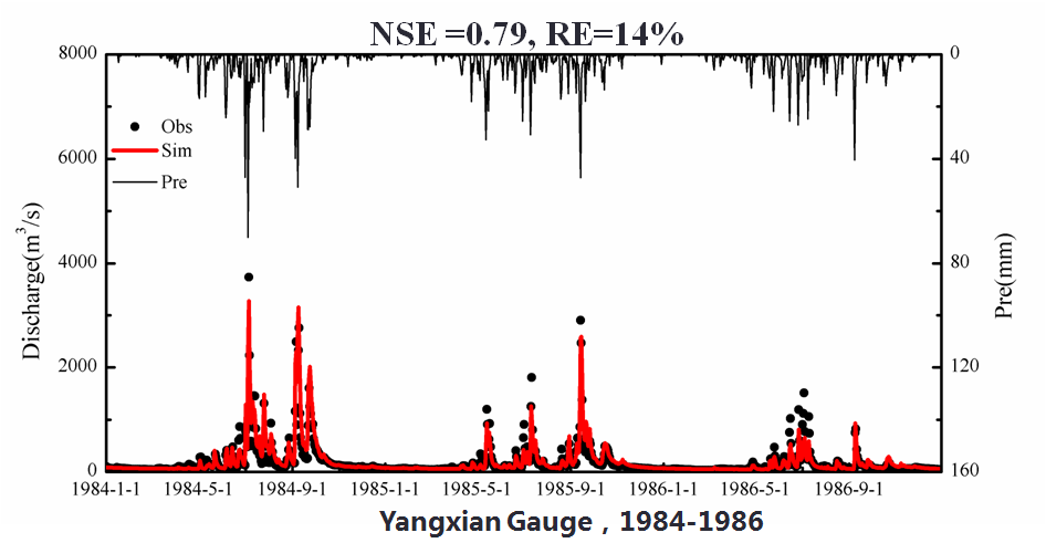
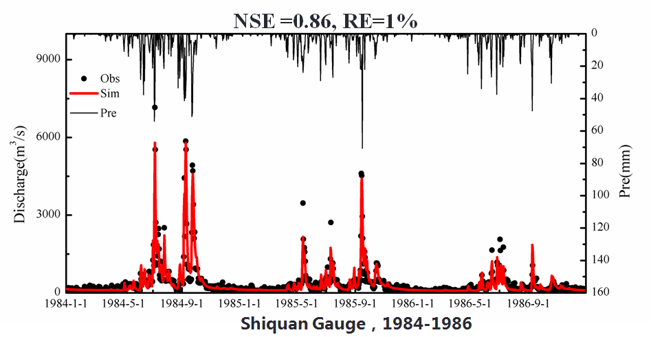
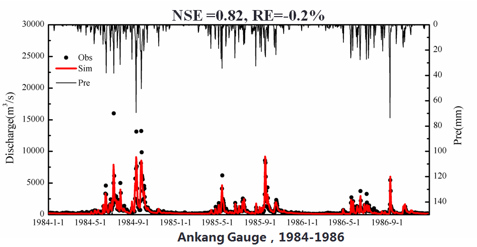
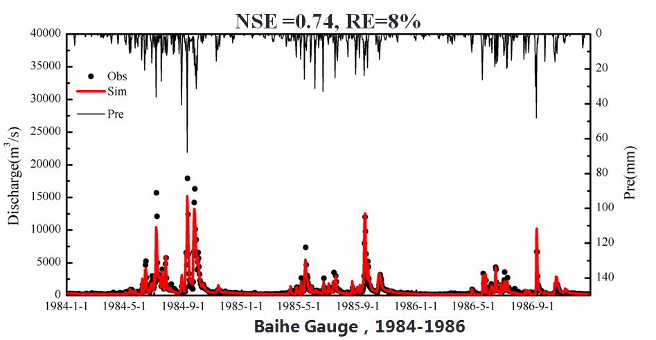
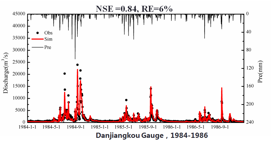
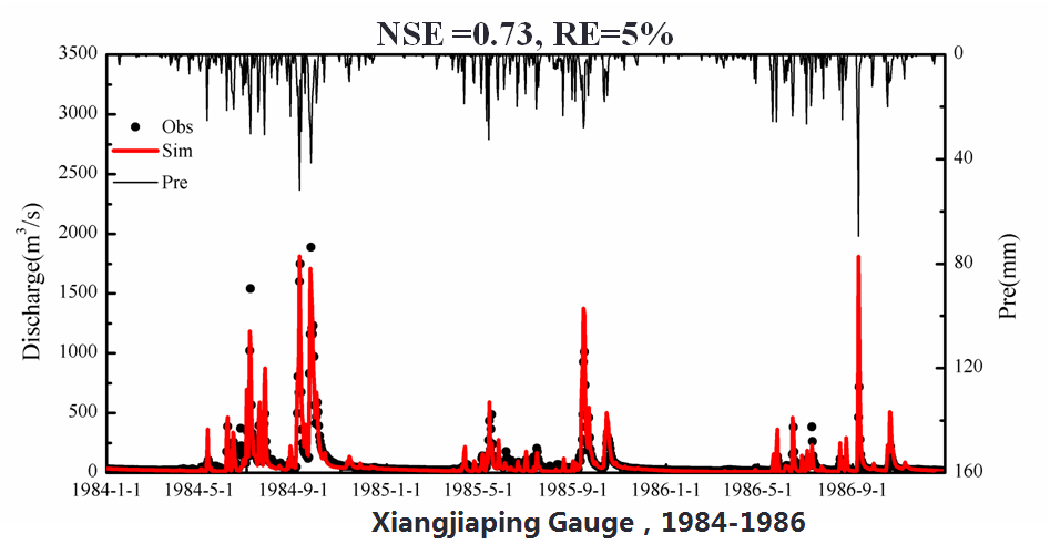
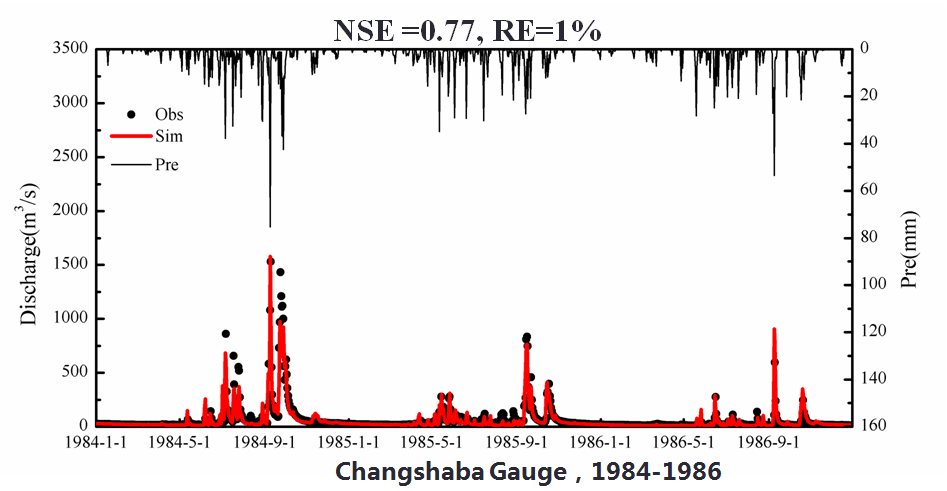
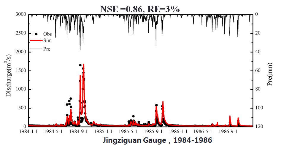
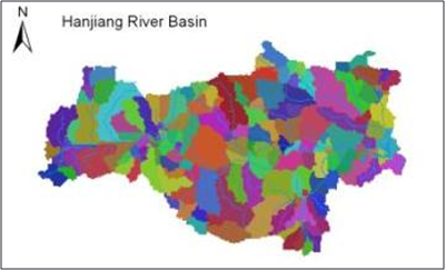
The present GBHM used a 2-km resolution grid system and constructed the distributed hydrological model using a basin subdivision scheme. Hanjiang River basin was divided into 169 third level subcatchments. Calibration period was from 1981 to 1983 and validation period was from 1984 to 1986. 6 gauges on stem river and 3 on tributary are chosen as the test gauges.
Validation Results
Validation results are displayed in the table below. From this talbe, we can see that RE are within 15% both in the calibration and validation. NSE is close to 0.8 or higher than this. These results render confidence in the use of the numerical model for this study.